Leave a Message

Thank you for your message. We will be in touch with you shortly.

Evaluating Gulf Access In Aqualane Shores

January 1, 2026

Are you picturing mornings where you step from your lanai to your boat and reach open Gulf water in minutes? In Aqualane Shores, that vision is absolutely possible, but access varies lot by lot. If you want the right fit for your boat and lifestyle, you need to evaluate canal geometry, maneuvering room, speed zones, and real run times to Gordon Pass. This guide gives you a practical, repeatable way to judge each property with confidence. Let’s dive in.

What Gulf access means here

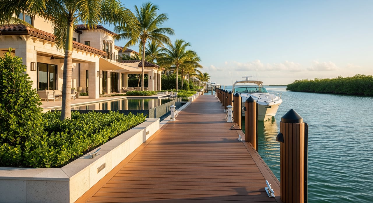
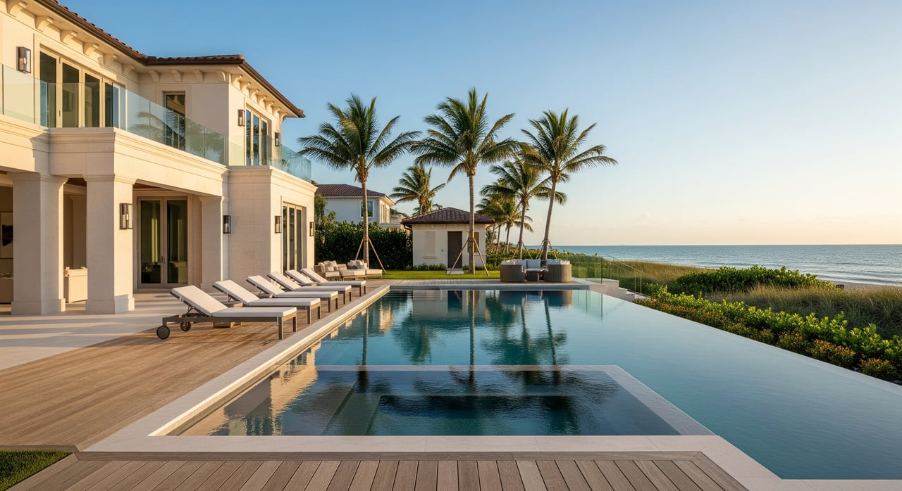
Aqualane Shores is a waterfront neighborhood with canals that feed into Naples Bay and then to Gordon Pass and the Gulf of Mexico. Your path to the Gulf depends on your specific canal exit, the route you take through Naples Bay, and day‑to‑day conditions like tide, shoaling, and traffic. Two homes on different streets can feel very different on the water, even if they look similar from the curb.

Convenience, safety, and boat size all come down to the details you verify on site and on charts. Keep your goal clear: match the property’s water capability to the boat you intend to keep at the dock.

Start with canal geometry

Measure width and depth

Your first priority is the water you control at your dock and on your route to Naples Bay.

  • Measure canal width at your frontage and at any narrow points on the way out.
  • Confirm depth at mean lower low water. Ask for a recent dock or lift survey that notes depth at low tide, and consider a professional sounding.
  • Note seasonal shoaling patterns and whether neighbors report trouble at low tide.

Practical thresholds you can use:

  • Small runabouts or center consoles often draw under about 2 to 3 feet and may manage narrower canals with ease.
  • Mid‑size express cruisers and sportfishing boats need more depth and straighter water to avoid repeated maneuvering. Aim for several feet at low tide and enough width to turn comfortably.
  • Larger boats over roughly 30 to 35 feet benefit from wider, deeper, straighter canals or a bayfront approach. Shallow canals push you toward a lift or marina.

Turning room and end‑of‑canal benefits

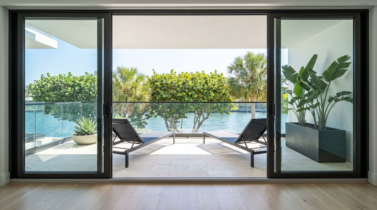
Turning basins, end‑of‑canal lots, and corner lots create extra maneuvering room. The more room you have to turn into the slip and line up on approach, the safer and simpler your docking will be. Check where the bulkhead sits relative to the active waterline at low tide to avoid surprises on draft and fender placement.

Maneuverability and lot orientation

Lot types and handling

  • Bayfront or seaward‑facing lots tend to have the most direct access and quicker routes into Naples Bay. These usually offer the best approach angles for larger boats.
  • End‑of‑canal lots reduce neighbor traffic and often give you more swing room. Serious boaters value this space.
  • Mid‑canal lots can be more budget‑friendly, but narrow water or heavy traffic can make docking trickier.
  • Corner lots often add dock frontage and allow wider approach angles.

Orientation, wind, and current

East‑facing or bay‑oriented lots can reduce turns and time to reach the channel. Plan for typical afternoon sea breezes that may push you on or off the dock. In passes, tidal exchange can create stronger current, so test how your intended route feels during different stages of tide.

Dock, lift, and seawall checks

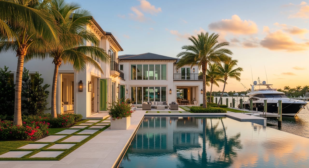
Inspect existing fixed docks, pilings, lifts, and controls. Confirm lift capacity for your boat’s weight, length, and beam. Evaluate seawall or bulkhead condition and elevation for safe docking and long‑term resilience.

Wake, manatee, and speed zones

Within residential canals and much of Naples Bay, expect posted slow‑speed or no‑wake rules. Manatee protection zones and seasonal slow areas can also apply. These regulations shape how quickly you can get from dock to open water. Before you buy, confirm the posted zones on your intended route and plan your typical trip with realistic speeds.

Tides, shoaling, and seasonal conditions

Gordon Pass and segments of Naples Bay are subject to shoaling and periodic dredging. Storms and seasonal sediment movement can change sandbar locations and effective depths. Low tide in Southwest Florida can meaningfully reduce your navigable water in narrower canals, so verify depth at low tide, not just mid‑tide. Ask local marinas or tow operators about any recent shoaling hot spots or changes after storms.

How long to Gordon Pass?

Time on the water is distance divided by speed, but speed limits and traffic matter. Many Aqualane Shores properties sit roughly 1 to 3 nautical miles from the Gordon Pass approaches, depending on the canal and route. At 20 knots, 1 nautical mile is about 3 minutes, 2 miles about 6 minutes, and 3 miles about 9 minutes of pure cruise time. In reality, no‑wake segments and turns add minutes. Under favorable conditions, many owners experience single‑digit to mid‑teens minutes from dock to the pass, but you should verify by lot.

A quick way to estimate your time:

  1. Measure the nautical miles from your canal exit to the pass approaches.
  2. Mark segments where you must run slow or no‑wake.
  3. Apply realistic speeds by segment, then add a buffer for traffic and tide.
  4. Test your route during a typical busy time to confirm.

A walk‑the‑map comparison framework

When you compare streets and lots, use a consistent method so your short list reflects how you actually use your boat.

  • Measure both straight‑line and channel route distances to the main channel and to Gordon Pass.
  • Count canal bends and pinch points; more turns usually means more handling and time.
  • Note whether it’s an end, corner, or mid‑canal lot and estimate linear dock frontage.
  • Observe neighbor dock placements and boat traffic.
  • Compare published or observed depths, and flag any canal mouths known for shoaling.

Practical trade‑offs to weigh

  • Seaward, corner, and end lots usually cost more, but they deliver better access and easier handling for larger boats, with potential resale benefits for boating‑focused buyers.
  • Mid‑canal lots offer a lower entry point. You may trade up‑front savings for concessions like a smaller boat, a lift, or keeping a larger vessel at a marina.
  • Existing permitted large docks and high‑capacity lifts add convenience and value. Verify that permits are current and transferable.
  • Shallow canals or areas prone to shoaling can mean future dredging or routing workarounds. Include potential maintenance in your ownership plan.

A buyer’s verification checklist

Use this nine‑step process to de‑risk your decision and confirm a property’s practical Gulf access.

  1. Pull a current nautical chart of the lot and trace your route to Gordon Pass.
  2. Obtain recent soundings for your canal segment and canal mouth; ask for dock or lift surveys.
  3. Visit at low tide to observe actual depth at the dock and along the canal; hire a marine surveyor if needed.
  4. Confirm Collier County permits for the dock, lift, and seawall; ask about any planned dredging projects.
  5. Match your intended boat to the dock and lift: length, beam, draft, and lift capacity.
  6. Verify posted slow‑speed and no‑wake zones along your route through Naples Bay.
  7. Ask local marinas or boatyards about current shoaling and typical transit times.
  8. Get insurance quotes that reflect keeping your boat at the private dock.
  9. Review long‑term county and coastal plans related to sea level rise and shoreline maintenance.

Permitting, insurance, and resilience

Replacing or enlarging a dock typically requires local and state permits, and in some cases federal approvals for submerged lands. Not all existing structures are permitted the same way, so request records and confirm what is grandfathered. Many waterfront lots fall within mapped flood zones, which affect insurance costs and any future building elevation work. Sea level rise and storm surge risk can increase maintenance needs for docks and seawalls over time. Build a plan that covers routine upkeep, storm readiness, and permitting lead times.

When a lift or marina makes sense

If your preferred lot lacks the depth or width for a deep‑V boat or a vessel over roughly 30 to 35 feet, a high‑capacity lift can be a smart solution. Where turning room is tight, lifts can also protect props and shafts during low‑tide hours. For very large boats or when you prefer maximum Gulf run speed right away, consider keeping a larger vessel at a marina and a smaller inshore boat at home. This split approach often balances convenience, budget, and safety.

Your next step

Evaluating Gulf access in Aqualane Shores is about clarity. Confirm depth at low tide, measure turning room, map your speed‑restricted segments, and calculate a realistic run time to Gordon Pass. With a focused checklist and local expertise, you can align the right lot with the right boat and enjoy the waterfront lifestyle you’re envisioning.

If you’d like a guided, property‑specific assessment—including coordination with surveyors, permitting checks, and realistic time‑to‑pass modeling—connect with Michael Dekic for concierge support.

FAQs

How do I know if my 30–35 ft boat fits at an Aqualane Shores property?

  • Verify low‑tide depth at the dock, canal width along your route, turning room near the slip, and lift capacity for length, beam, and weight; get a recent sounding to be sure.

What is a realistic time from dock to Gordon Pass in Aqualane Shores?

  • Many owners experience single‑digit to mid‑teens minutes, depending on canal, no‑wake zones, traffic, and tide; measure your route and test during typical conditions.

Do speed and manatee zones affect my Gulf run in Naples Bay?

  • Yes; posted slow‑speed and manatee protection zones restrict speed in canals and parts of Naples Bay, so plan your transit time around those regulated segments.

How should I account for shoaling near Gordon Pass?

  • Ask local marinas or tow operators about recent conditions, review any dredging updates, and test your route at low tide; expect post‑storm changes.

Will I need permits to modify or replace a dock in Aqualane Shores?

  • Most dock, lift, and seawall work requires permits; confirm existing approvals and what is grandfathered, and check county and state requirements before planning changes.

Is an end‑of‑canal or corner lot worth the premium for boaters?

  • Often yes if you run a larger boat; added turning room, wider approach angles, and simpler lines to Naples Bay can improve safety, convenience, and resale appeal.

Work With Me

Meet Michael Dekic, your dedicated real estate expert. Ready to guide you to your dream home!